


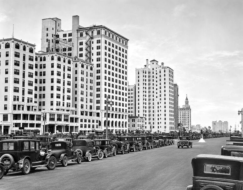
In the mid-1920s, Miami was experiencing an extraordinary period of growth and transformation. The Florida land boom had attracted investors, developers, and new residents from across the country, creating an unprecedented demand for improved roads, modern infrastructure, and new residential communities. Among the most ambitious transportation projects conceived during this period was Biscayne Boulevard, a grand thoroughfare envisioned to connect downtown Miami with the rapidly developing neighborhoods to the north.
Construction began in December 1925, and although the project encountered financial difficulties, property acquisition challenges, and the devastating hurricane of September 1926, Miami celebrated the dedication of its first completed section on November 11, 1926. The occasion coincided with Armistice Day, providing an opportunity for the city to honor its veterans while celebrating a major milestone in its continued development.
The dedication also represented something more meaningful. Less than two months after one of the most destructive hurricanes in American history had devastated Greater Miami, the celebration demonstrated the city’s determination to recover, rebuild, and continue pursuing its ambitious vision for the future.
The Vision for Biscayne Boulevard
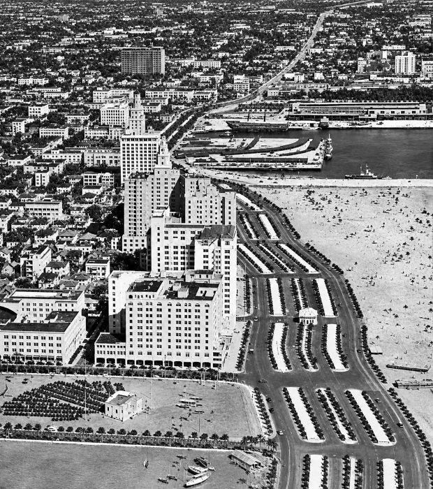
The origins of Biscayne Boulevard can be traced to the development ambitions of Hugh Anderson and Roy C. Wright, principals of the Shoreland Company, which was responsible for developing Miami Shores during the height of the Florida land boom.
As their residential development expanded north of downtown Miami, Anderson and Wright recognized the importance of creating a modern transportation corridor connecting their properties with the city’s commercial center. Improved access would not only benefit residents of Miami Shores but also increase the desirability and value of properties along the proposed route.
Anderson and Wright imagined Biscayne Boulevard as a prestigious, landscaped thoroughfare that would serve as both a transportation artery and an attractive commercial and residential gateway to Miami. The boulevard would feature coordinated architectural development, attractive landscaping, modern facilities for motorists, and a roadway wide enough to accommodate the city’s anticipated growth.
The proposed roadway would generally measure 100 feet in width, considerably wider than many of Miami’s existing streets. Certain sections near the waterfront would be even broader, allowing for landscaped public spaces and an impressive approach to the city’s downtown district.
Acquiring the Right-of-Way in 1925

Transforming this vision into reality required the Shoreland Company to assemble a continuous right-of-way between the northern developments and downtown Miami. Unlike roads constructed entirely through undeveloped land, the proposed Biscayne Boulevard would traverse a combination of vacant parcels, established residential neighborhoods, and existing streets. Acquiring the necessary property required negotiations with landowners and, in certain locations, the removal of existing structures.
One of the most significant early transactions involved property owned by Charles Deering near today’s Buena Vista neighborhood. The acquisition of this property was an important step to ensure the continuity of the proposed corridor. The Deering property transaction was completed on December 5, 1925, clearing a major obstacle to the beginning of construction.
Just ten days later, on December 15, 1925, construction of Biscayne Boulevard officially began under the direction and financing of Anderson and Wright’s Shoreland Company. The project was among the most ambitious roadway improvements undertaken in Miami during the land boom.
Construction Accelerates During 1926
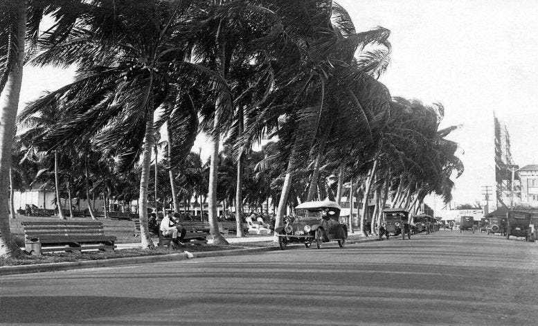
Throughout the first half of 1926, work progressed on the boulevard as construction crews cleared land, removed obstructions, assembled remaining properties, and prepared the new roadway. The project presented different engineering and construction challenges depending on the location.
In the southern portion, the proposed boulevard incorporated the existing North Bayshore Drive, an established waterfront avenue extending north from downtown Miami. This section was already surrounded by hotels, apartment buildings, commercial establishments, and private residences, many of which had been constructed years before the boulevard was conceived.
Rather than creating an entirely new roadway, workers had to reconstruct and widen portions of the existing street system while accommodating the surrounding development. Farther north, the project involved widening old Northeast Third Avenue and cutting entirely new roadway extensions through established city blocks and previously undeveloped property.
The undertaking ultimately involved cutting new extensions through 14 city blocks and continuing the boulevard northward to its planned connection with the Federal Highway at Northeast 55th Street. The completed project was designed to create a continuous thoroughfare measuring approximately three and a half miles in length.
Although the boulevard was generally planned to be 100 feet wide, its dimensions varied along the route. The roadway would measure approximately 230 feet wide along Bayshore Park, 180 feet through Miami Plaza, and 100 feet along the remainder of its course. These generous dimensions reflected the developers’ desire to establish Biscayne Boulevard as one of Miami’s most attractive and important transportation corridors. By the summer of 1926, the transformation of the city’s northern waterfront and adjoining neighborhoods was well underway.