


Before Miami City Councilman Josiah Chaille introduced his plan to reorganize the city’s street names, Miami followed a relatively simple naming convention that assigned letters to avenues and numbers to streets. Avenues were designated alphabetically, beginning with Avenue A near Biscayne Bay and progressing westward to Avenue K at the city’s western boundary. Streets were numbered sequentially from north to south, beginning with First Street near the northern city limits and continuing to Broadway, which marked the southern boundary. Broadway is known today as SE Fifteenth Road.
Although this system served Miami during its earliest years, its limitations became increasingly apparent as the city expanded beyond its original boundaries. The annexation of unincorporated areas to the north and west in 1913, combined with expectations of substantial growth during the 1920s, made the existing naming convention impractical.
City leaders recognized the need for a more organized and scalable approach to identifying streets and assigning addresses. Chaille’s proposal offered a solution: a comprehensive grid system, modeled in part on Washington, D.C., that could accommodate Miami’s continued expansion while bringing greater consistency to its street layout.
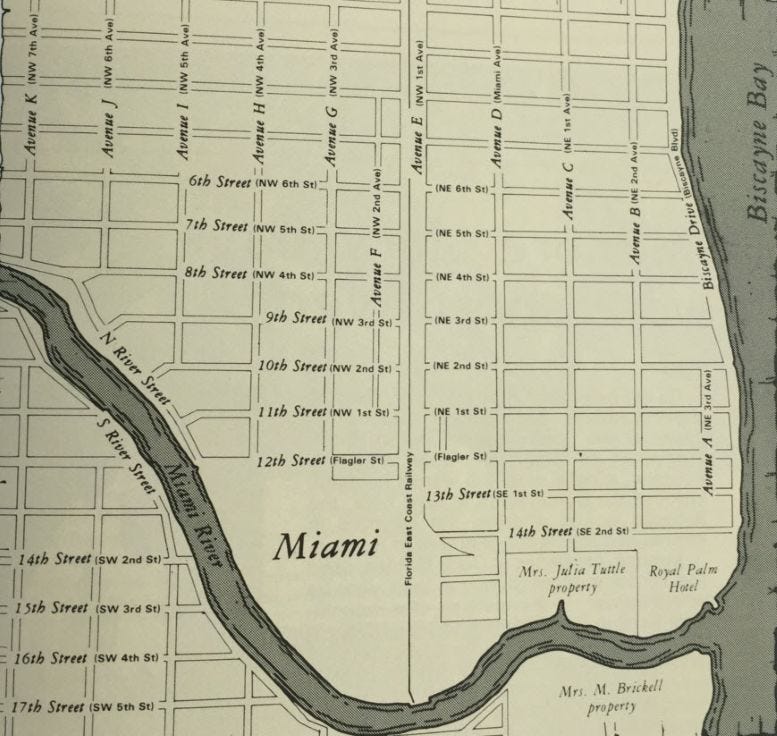
Recognizing the limitations of Miami’s original street-naming system, Chaille introduced a proposal that would reorganize the city’s thoroughfares into a more logical and expandable grid. At the heart of his plan was the intersection of Twelfth Street and Avenue D, renamed to Flagler Street and Miami Avenue as part of the new grid system. This intersection became the central reference point from which all streets and avenues would be numbered and assigned directional designations.
