

Mouth of the Miami River in 1925
An aerial view of the mouth of the Miami River in 1925 showcasing the Royal Palm Hotel, Royal Palm docks, Bayfront Park, Fort Dallas Park, Brickell Point, and a burgeoning Burlingame Island.

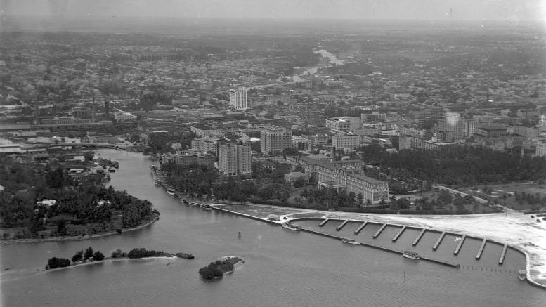
This featured photograph captures the mouth of the Miami River in 1925, a pivotal year in the city’s early development. In that same year, Bayfront Park was created on land dredged from Biscayne Bay, and a portion of the new park is visible to the right of the river in the image. Before Bayfront Park’s completion, downtown Miami’s only public green space was Royal Palm Park, built by the Florida East Coast Railway and privately owned. In the photo, Royal Palm Park appears above and to the right of the sandy yacht basin.
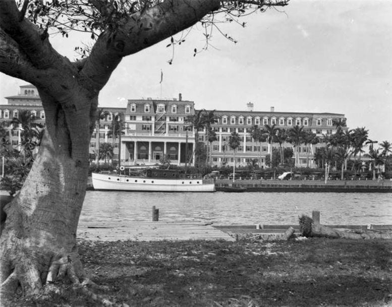
The year 1925 also marked the final full season of operation for the Royal Palm Hotel. Severely damaged by the devastating 1926 hurricane, the hotel never recovered. A section of the structure was demolished in 1928 to make way for the new Brickell Avenue Bridge, which extended north to NE Second Avenue. By 1930, the hotel was completely razed. Despite the loss of this early Miami landmark, the FEC docks on the southern edge of Bayfront Park continued to operate for several more years.
At the center of the photograph is Fort Dallas Park, a subdivision platted by Harry Tuttle shortly after his mother’s passing in 1898. Initially developed as a residential neighborhood of single-family homes, the area maintained this character until the mid-1910s. By the 1920s, however, Fort Dallas Park had transformed into a cluster of mid-rise apartment buildings and small hotels. Many of these early structures remained standing well into the 1970s.
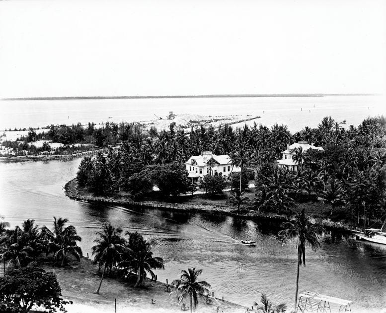
In the foreground lies a spoil island once known as Burlingame Island. In the early 1910s, Mary Brickell offered to remove the landmass at her own expense, but instead, the Florida Internal Improvement Fund placed it up for auction. The island was awarded to Mary Burlingame in 1916 and remained undeveloped until 1932, when it was purchased by E.J. Reed and expanded during the mid-1930s. A decade later, in 1943, developer Ed Claughton acquired the property, hence the modern name “Brickell Key” on Claughton Island.
North of the spoil island lies Brickell Point, which in 1925 was still home to several buildings constructed and owned by the Brickell family. In 1948, Maude Brickell sold the property to the Elks Lodge with the condition that she be allowed to reside in the family home for the remainder of her life. Following her passing in 1961, the site was redeveloped, and the Brickell Point Apartments were constructed in 1951 along the southern bank of the river.
Overall, this aerial photograph of the Miami River highlights its distinctive serpentine course. Over the decades, the river has evolved into one of Florida’s busiest working waterways, serving as a vital artery at the heart of the City of Miami.
Yes, that is a fascinating photo and narrative! It reminds me that even in 1925, Miami was already a pretty big place. And yet for so long it had a small town feeling.
Thank you, Casey! A fascinating look at the evolution of the Mouth of the Miami River!
Doug deWolfe
Odessa, Florida